We use cookies to ensure that we give you the best experience on our website. If you continue to use this site we will assume that you are happy with it. Read more about our Privacy Policy and Cookie Policy
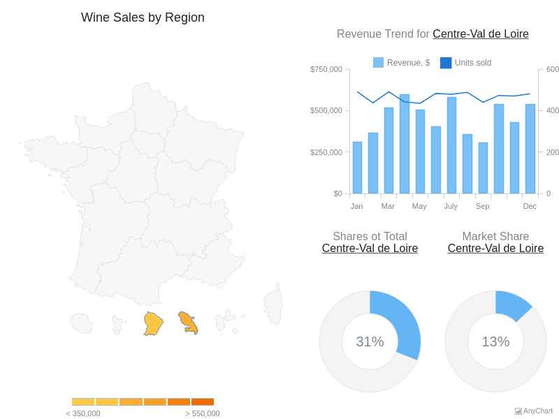
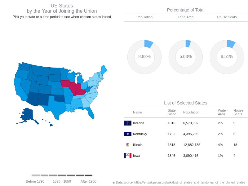
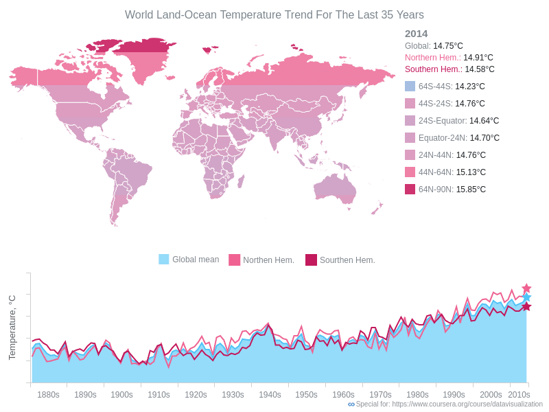
Dashboard layouts that combine AnyMap geo-visualizations with companion charts and tables. Explore U.S. state dashboards, multi-select interactions, and coordinated map-chart views.