Warning!
We use cookies to ensure that we give you the best experience on our website. If you continue to use this site we will assume that you are happy with it. Read more about our
Privacy Policy
and
Cookie Policy
Отдел продаж:
+1 (279) 499-2767 (США)
или
+44 (800) 0584677 (Европа)
Русский
Português
日本語
Deutsch
العربية
汉语
Español
English
Вход для клиентов
Toggle navigation
продукты
AnyChart
AnyStock
AnyMap
AnyGantt
Mobile
Qlik Extension
Возможности
Ресурсы
Решения для бизнеса
Технические интеграции
Chartopedia
Tutorials
Поддержка
Компания
О компании
Клиенты
Истории успеха
Еще отзывы
Новости
скачать
купить сейчас
Поиск
Maps General Features
Core AnyMap features including GeoJSON/TopoJSON/SVG data sources, color scales, tooltips, labels, zoom controls, and world-map rendering options.
Обзор библиотеки
Галерея карт и картограмм
Документация
Дорожная карта
История версий
Chart Gallery
Maps General Features
Maps General Features
Select a theme:
Default
Dark Blue
Light Blue
Dark Earth
Light Earth
Dark Glamour
Light Glamour
Dark Provence
Light Provence
Dark Turquoise
Light Turquoise
Coffee
Monochrome
Morning
Pastel
Sea
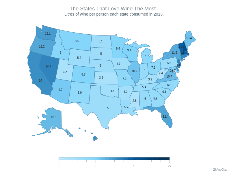
Wines
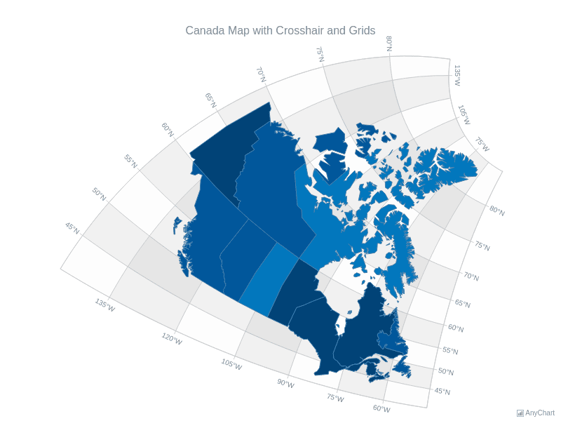
Canada Map with Crosshair and Grids
Canada choropleth map with geographic crosshair and grid lines.
Choropleth Map using Google Spreadsheet
Choropleth Map visualizing data from Google Spreadsheets.
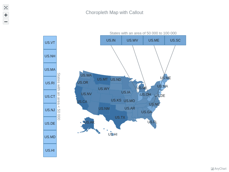
Choropleth Map with Callout
US choropleth map with callout groups for small states.
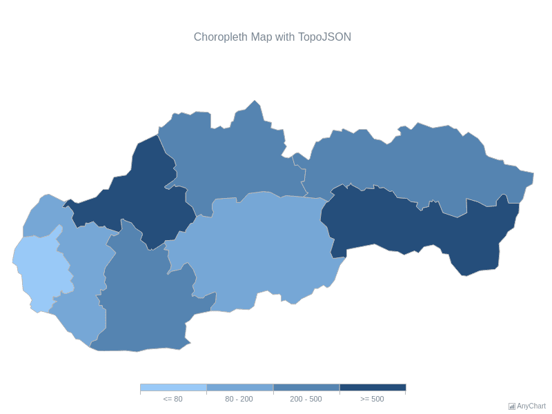
Choropleth Map with TopoJSON
Slovakia choropleth map created from TopoJSON geodata.
Chart tooltips with HTML layout
Italy travel map with custom HTML tooltip content.
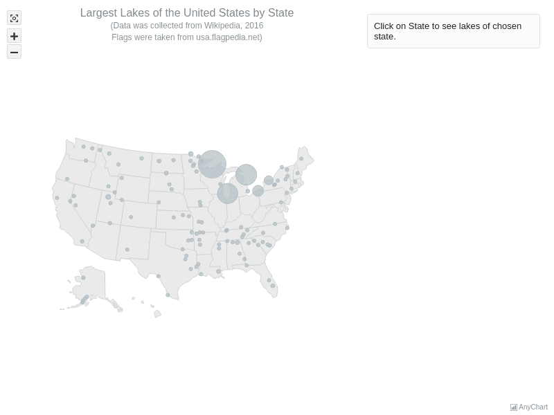
Largest Lakes of USA by State
Interactive USA map of states and largest lakes.
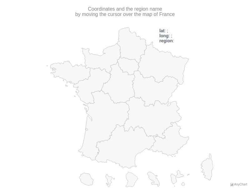
Lat Long API Demo
France map showing live latitude and longitude coordinates.
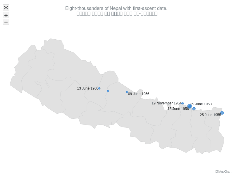
Map with Nepal Localization
Nepal bubble map with Nepali locale and date formatting.
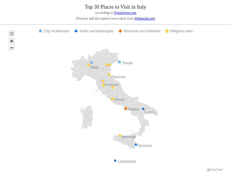
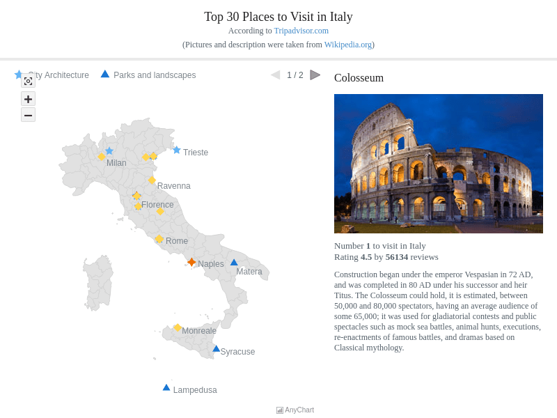
Top 30 Places to Visit in Italy
Italy tourism map of top places to visit.
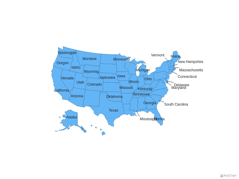
USA Map With Outside Labels
USA choropleth map with outside state name labels.
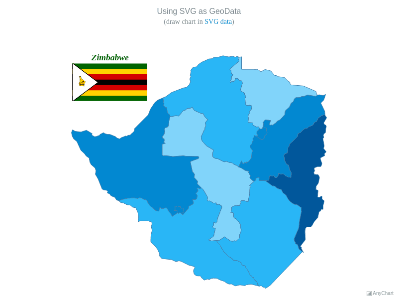
Using SVG as GeoData
Map choropleth built from custom SVG geodata.
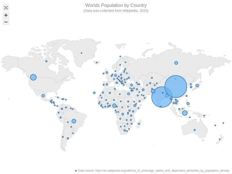
World Bubble Map
World bubble map of population and density by country.
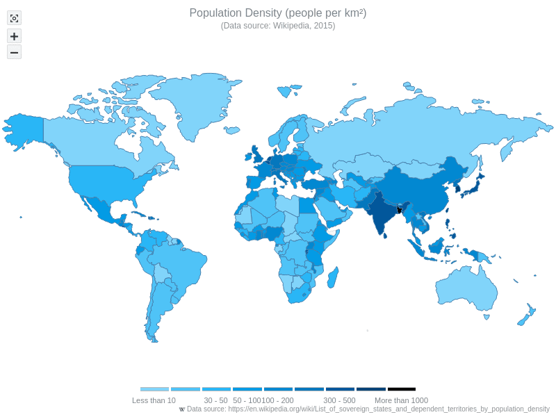
World Choropleth Map
World choropleth map of population density by country.
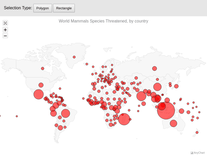
World Mammal Species Threatened
World bubble map of threatened mammal species.
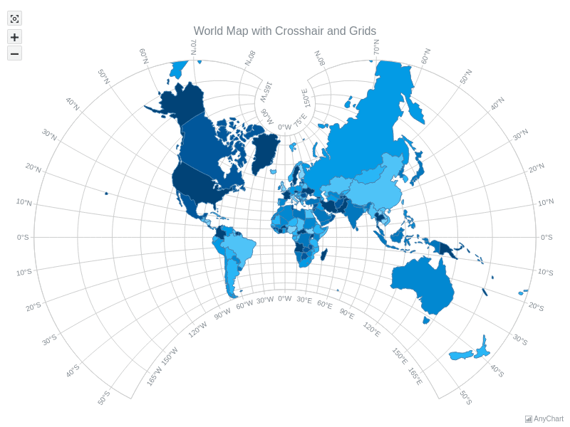
World Map with Crosshair and Grids
World choropleth map with crosshair, axes, and grids.